As always, here is the map of today’s road trip on the north side of Iceland


The north of Iceland offers a completely different nature experience. Some of these places look like you are in another planet like Mars. After a long drive starting in Egilsstadir, our first stop was at the Namafjall geothermal area.

In 1969 a geothermal power plant was built west of the Námafjall Area. The plant currently produces 3MW of geothermal energy. Iceland has done an excellent job generating green energy from their land!
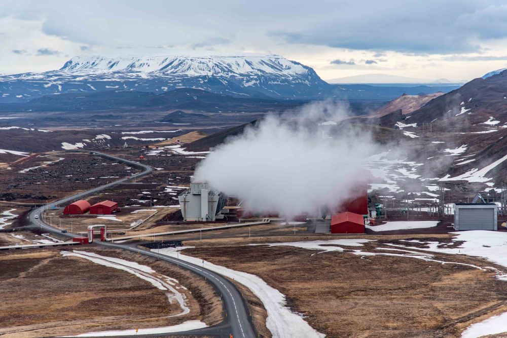
At this area, also known as Hverir, you will see many smoking fumaroles and boiling mud pots, surrounded by sulphur crystals of many different colours. This sulphur gives the area an overwhelming smell of rotten egg.

It lies under the Namafjall mountain that belongs in the Krafla volcano fissure zone.
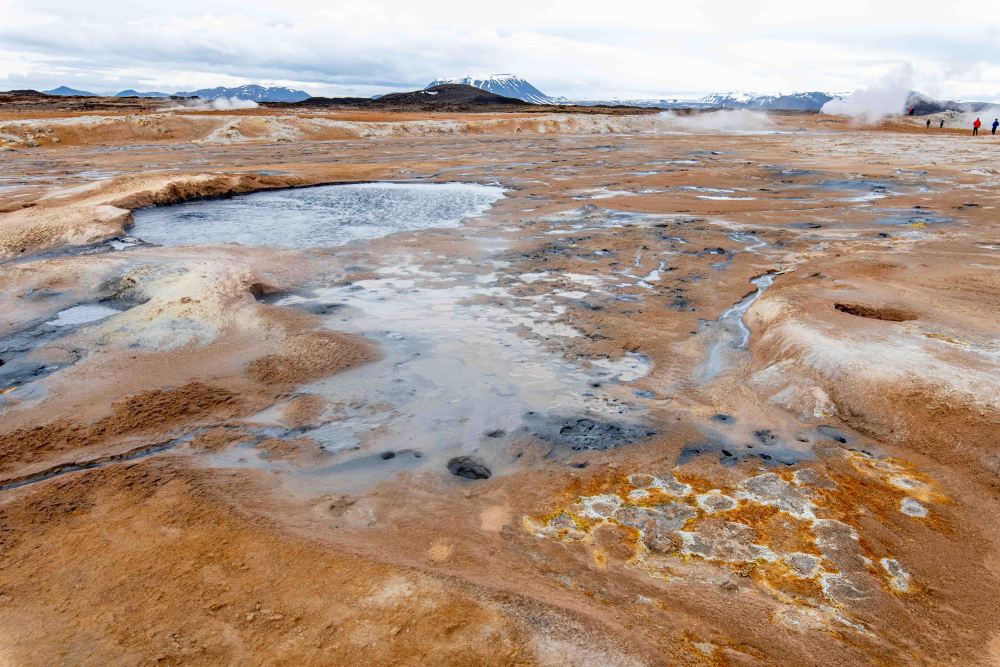
The soil in the area has little vegetation due to the acidity caused by these geothermal processes.

At a depth of 1000 meters, the temperature is above 200°C. The water that flows below the surface is quickly heated and comes back to the surface transformed into steam.


This is Eitan taking the nice photos you see in this blog, and Sarah making him company!

The smell is bad, but we have gotten accustomed to Aaron’s smell, which is very similar.

We jumped in the car for a quick ride to the top of the Krafla Volcano! Krafla is a caldera, part of a greater volcanic system of the same name, located north of Lake Mývatn in North Iceland. It is one of the country’s most explosive volcanoes, having gone off approximately 29 times since the country was first settled.

The crater of Krafla’s caldera is about ten kilometres (seven miles) wide, although its fissure zone extends for 90 kilometres (56 miles). The Víti crater is located in this fissure zone, famed for the green lake within it, which was frozen when we visited.

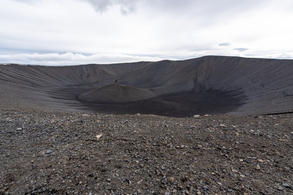
Continuing our volcano-themed day, we stopped at the Hverfjall crater. The volcano, which is a part of the Krafla fissure swarm, erupted in 2500 BC. The crater is approximately 1 km in diameter. Walking the steep slopes offers a great view of the Lake Myvatn area.
The walk up is not terribly difficult.

The view is nice from the top.
This is Eitan bombing what could have been a very nice Wolf family photo. You are welcome.

The rim of the crater is only accessible by two paths, from the northwest and south. It is strictly forbidden to use other routes in ascent or descent.

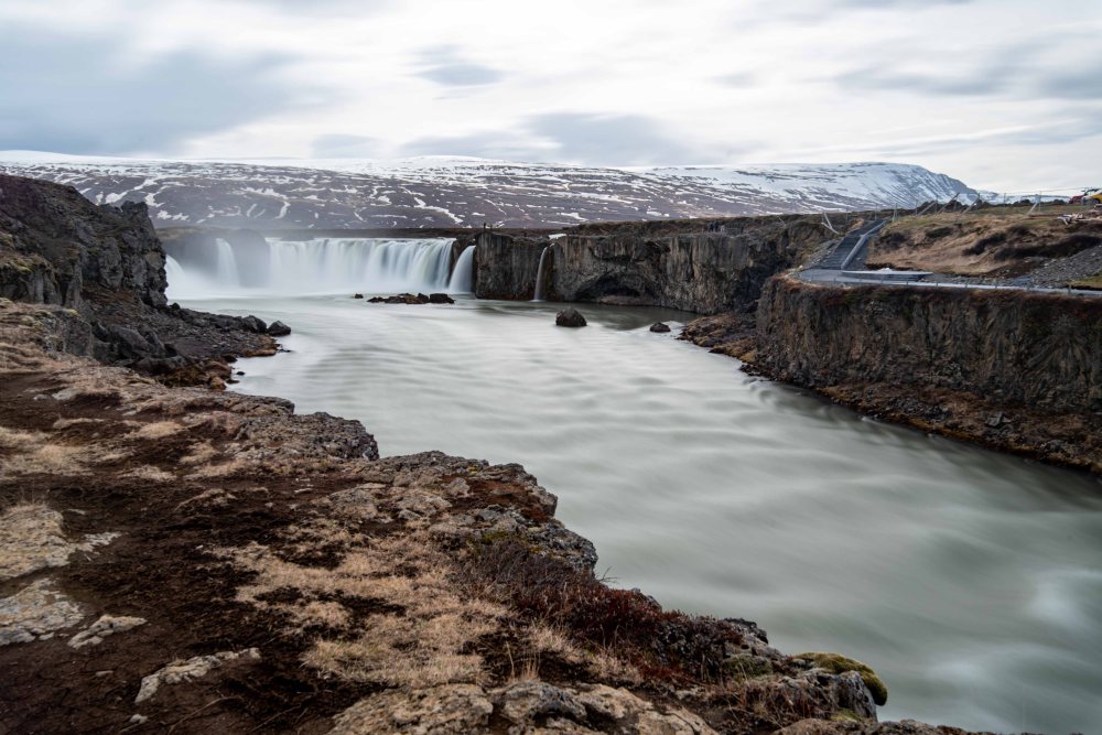
The next stop was another impressive waterfall. The Goðafoss Waterfall is located in the river Skjálfandafljót in north Iceland, the fourth-largest river in Iceland. It is one of the most spectacular waterfalls in the country, falling from a height of 12 meters (39 feet) over a width of 30 meters (98 feet).
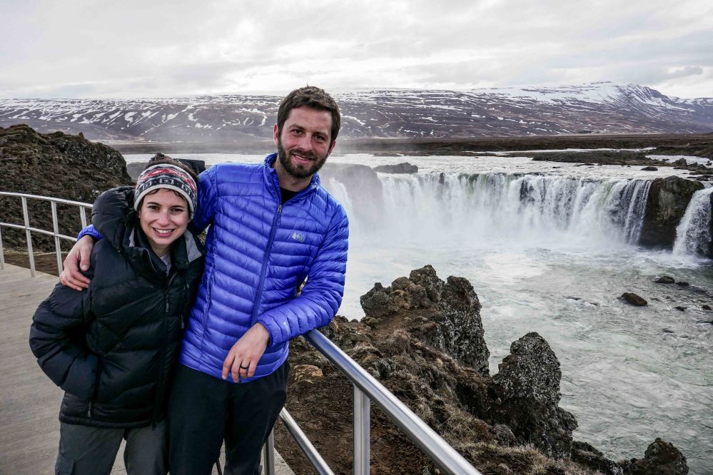
The name Goðafoss means either waterfall of the gods or waterfall of the ‘goði’. The reason for this is its fascinating history.
When Iceland was first settled in the 9th and 10th Centuries, the vast majority (those who were not slaves, at least) were Norwegians who followed the Old Norse religion, worshipping deities like Thor, Odin, Loki, and Freya. However, after the Commonwealth was established in 930 AD, pressure to convert began to push from Christianising Europe.
By 1000 AD, it seemed that Norway would almost certainly invade if the country were to stand by its pagan beliefs. The issue was thus discussed at Þingvellir, where the parliament met once a year. The lawspeaker at the time, the Ásatrú priest (or goði) Þorgeir Ljósvetningagoði, was given the responsibility to make the decision.
It is said he lay under a fur blanket for a day and a night in silence, praying to his Old Gods for the right decision. Eventually, he emerged and said, for the good of the people, Christianity would be the official religion, but pagans could practice in private.
To symbolize his decision, he returned to his home in north Iceland and threw idols of the Old Gods into a beautiful waterfall. Since then, it would be known as Goðafoss.

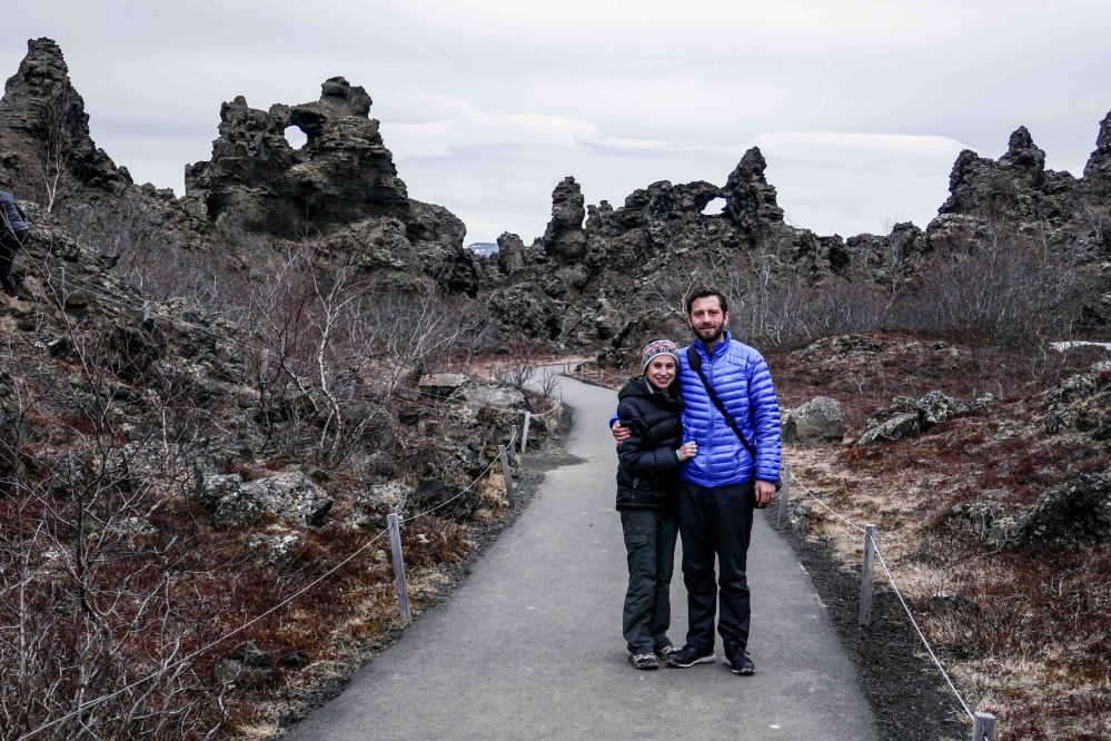
Our last stop of the day was Dimmuborgir, or the Black Fortress, which is a dramatic expanse of lava in the Lake Mývatn area.
Dimmuborgir was formed in an eruption that occurred in the area 2,300 years ago; the Lake Mývatn area is highly volcanic, as can be further seen in nearby locations such as the geothermal Námaskarð Pass, the hot spring cave Grjótagjá, and the dramatic Krafla fissure.

As lava flowed across the area, it passed over a lake, causing it to boil. This both quickened the cooling of the lava and caused pillars of steam to shatter parts of it. After it solidified, the Dimmuborgir area became defined by large stacks of rock and many caves and caverns, caused by bubbles of intense steam.

As such, many have compared Dimmuborgir to a medieval castle, with its many hidden chambers and its rising towers.

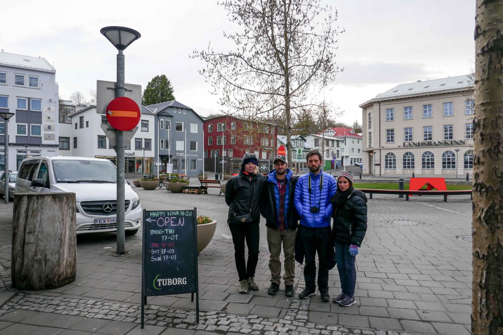
We finally arrived at our overnight destination, the town of Akureyri. Iceland’s second-largest city and “Capital of the North”has a whopping population of 19,000 people.

The town offers a lot of things to do, but we were just exhausted by the end of the day so we took it easy by just walking around the town.
The iconic Akureyri Church is considered one of the must-see Akureyri attractions. It’s conveniently easy to spot as it towers over the center of the city and dominates the town’s skyline.
It was consecrated in 1940 and, since then, has always been the most significant trademark symbol of the ‘Capital in the North.’
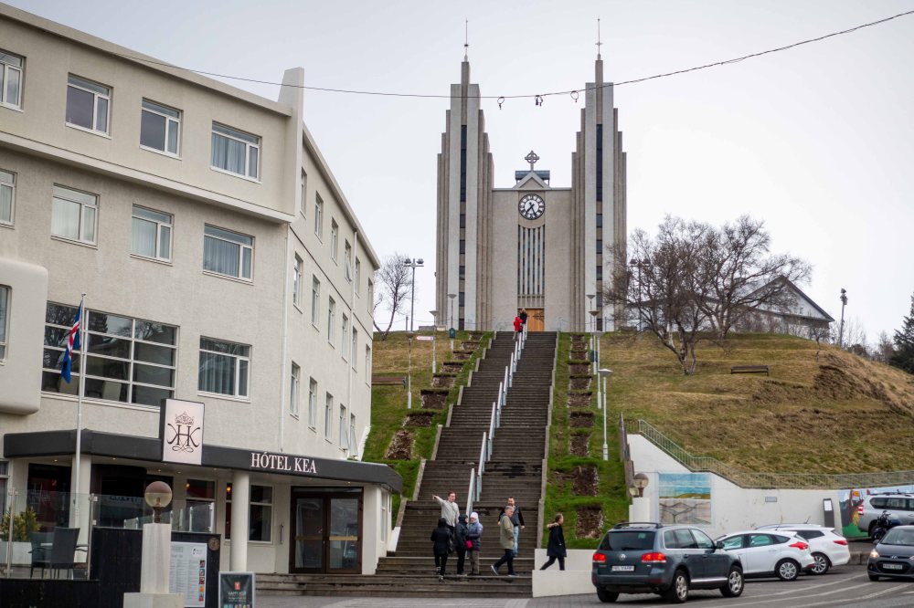
The stairs leading up to the church are no less iconic than the church itself, and Icelanders commonly challenge each other to race up the stairs. There is even an annual ‘church stair race’ event in July, where locals compete in multiple categories of who is fastest racing up the stairs.
Don’t get fooled by the photos, even though this looks like 2 pm, in reality, this was already nighttime (and Elly and Dan had gone to sleep already). In the month of May, there are around 20 hours of daylight!!
The kids stoped for a nice dinner in a hostel restaurant.

It was finally getting dark so we headed to the hotel to rest for our last day adventure!


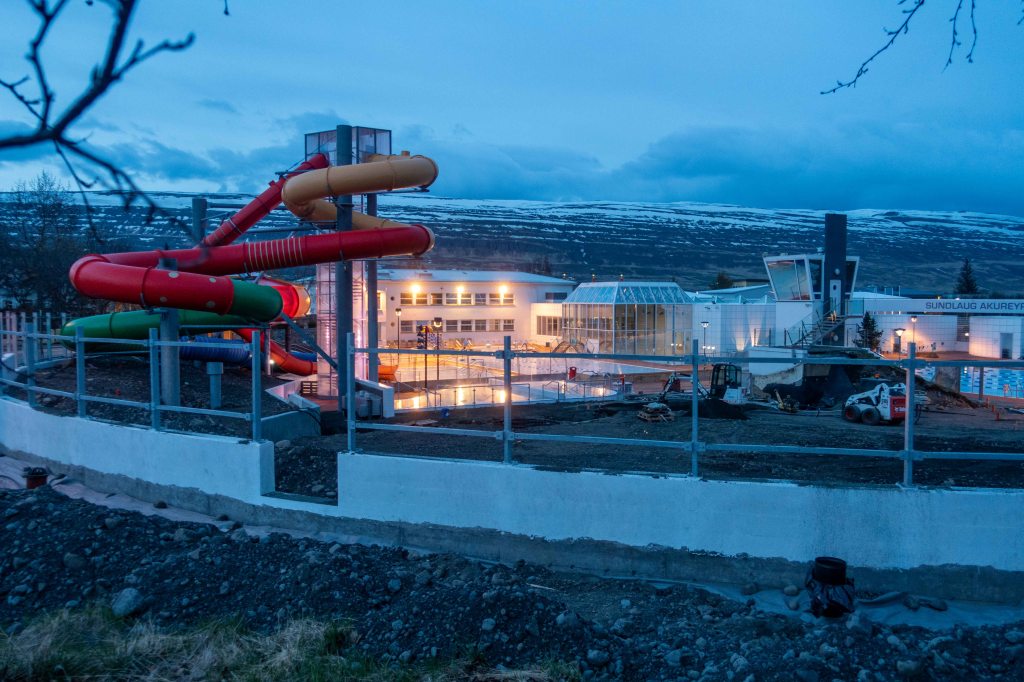
Icelanders also enjoy outdoor waterparks, the question is how many months a year can they actually use it.
The hotel views are always fantastic.

Bonus Pic of the day: I love seeing how other countries translate movie titles. Moana = Vaiana. In many European countries, the title and main character were changed to Vaiana to avoid referencing Italian actress Moana Pozzi. The voice actors had to come back and re-record some of their lines.