Day 2 of the Icelandic road trip was packed with exciting sights around the famous “Golden Circle”
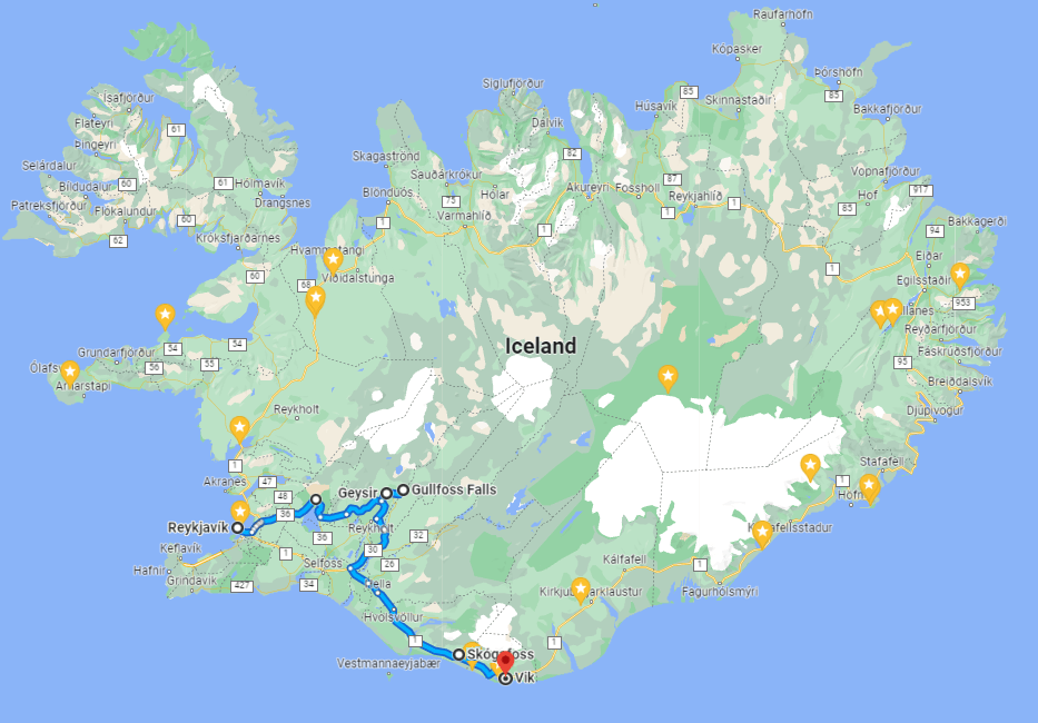
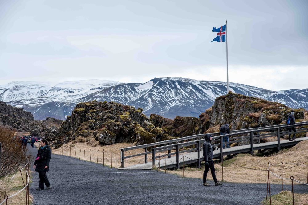
The first stop was at the Thingvellir National Park. After some quick changing of clothes we walked toward the main area.


Iceland is divided by the Mid-Atlantic Rift; some parts of it, such as the Westfjords and Reyjavík, are on the North American tectonic plate, while others, such as Vatnajökull glacier and the East Fjords, are on the Eurasian plate. Iceland is the only place in the world where this rift is above sea-level, and nowhere can you see the edges of both plates as clearly as in Þingvellir.

As you enter the park from Reykjavík, you descend a steep cliff into a valley. Looking upon the face of this cliff is to literally look at the edge of North America. If you drive through the park, you will ascend on the other side adjacent to another wall; this is Eurasia. The valley in between, in which Þingvellir is contained, is the rift valley.

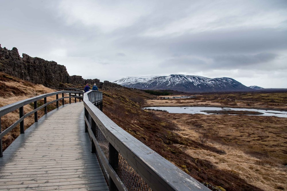
The tectonic plates move apart at approximately 2.5 cm a year and have done for millennia. The effects of this movement are very clear within the park. Lava fields fill the valley, from magma that welled up as the continents spread, and the whole area is littered with ravines, ripped open by centuries of earthquakes.
Earthquakes continue every day in Þingvellir, although most are far too minor to be felt. No volcano has gone off in the area in 2000 years, but they are not considered extinct. More eruptions are expected; the question is only as to when.

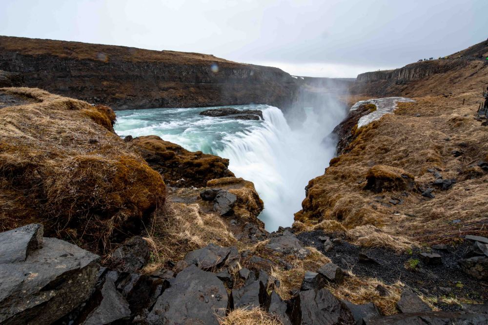
The next stop was the Gullfoss waterfall. As you might already know, Eitan is very obsessed with waterfalls, and if he had a chance, he would stop at every one of them (over 10,000 in Iceland) but unfortunately, we didn’t have the time during this trip, and he didn’t want to totally alienate the rest of the family.
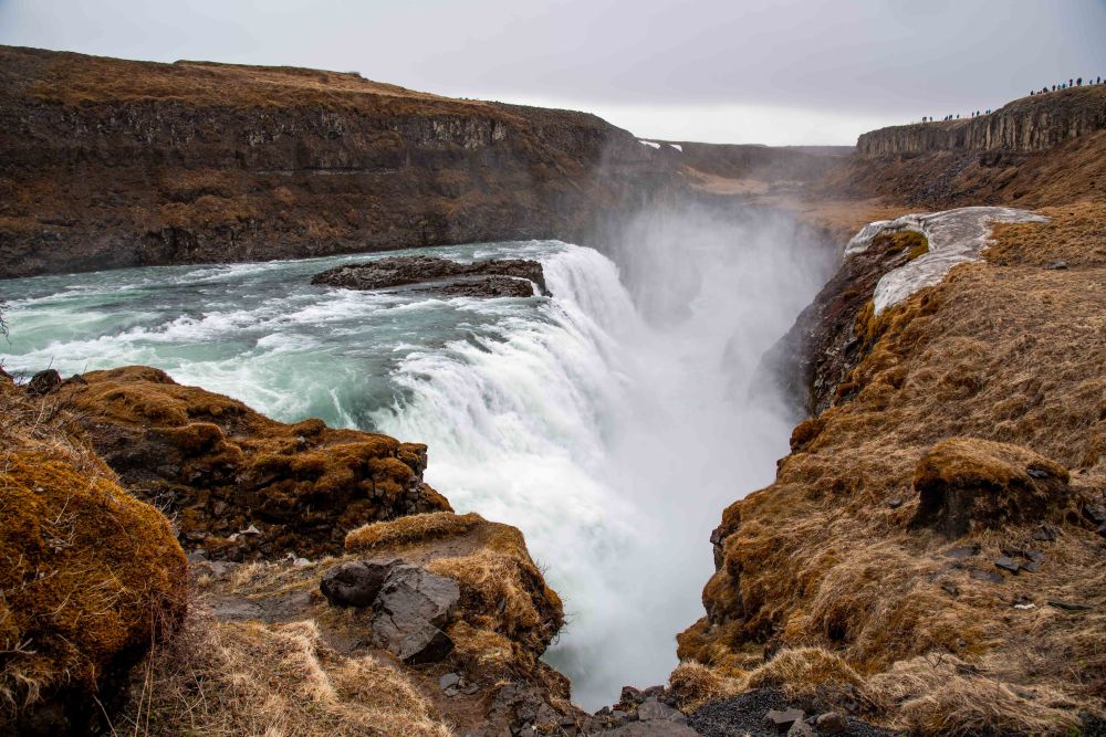
The water in Hvítá river travels from the glacier Langjökull, before cascading 32 meters (105 feet) down Gullfoss’ two stages in a dramatic display of nature’s raw power. This incredible site is seen by most visitors, as it is on the Golden Circle sightseeing route.
Because of the waterfall’s two stages, Gullfoss should actually be thought of as two separate features. The first, shorter cascade is 11 meters tall (36 feet), whilst the second drop is 21 meters (69 feet). The canyon walls on both sides of the waterfall reach heights of up to 70 meters (230 feet), descending into the great Gullfossgjúfur canyon. Geologists believe that this canyon was formed by glacial outbursts at the beginning of the last ice age.


In the early days of the last century, Gullfoss was at the center of a controversy regarding foreign investors and their desire to profit off Iceland’s nature. In the year 1907, an English businessman, Howell, sought to utilize the waterfall’s energy and harbored ambitions to use its energy to fuel a hydroelectric plant.
At the time, Gullfoss was owned by a farmer named Tómas Tómasson. Tómas declined Howell’s offer to purchase the land, stating famously “I will not sell my friend!” He would, however, go on to lease Howell the land without the knowledge of a loophole that would allow him to proceed with his plans.
It was Tómas’ daughter, Sigríður Tómasdóttir, who would lead the charge to stop Howell’s ambitions. Having grown up on her father’s sheep farm where she helped pave the first road to Gullfoss, she sought to get the contract nullified, hurriedly saving her own money to hire a lawyer.
The ensuing legal battle was an uphill struggle; the case continued for years, forcing Sigríður to travel many times by foot to Reykjavík, a distance of over 100 kilometers (62 miles). Circumstances became so difficult that Sigríður threatened to throw herself into the waterfall if any construction began.

We stopped at the gift shop to warm up and dress up.

The next stop was the Gaysir geothermal area located in the Haukadalur Valley.
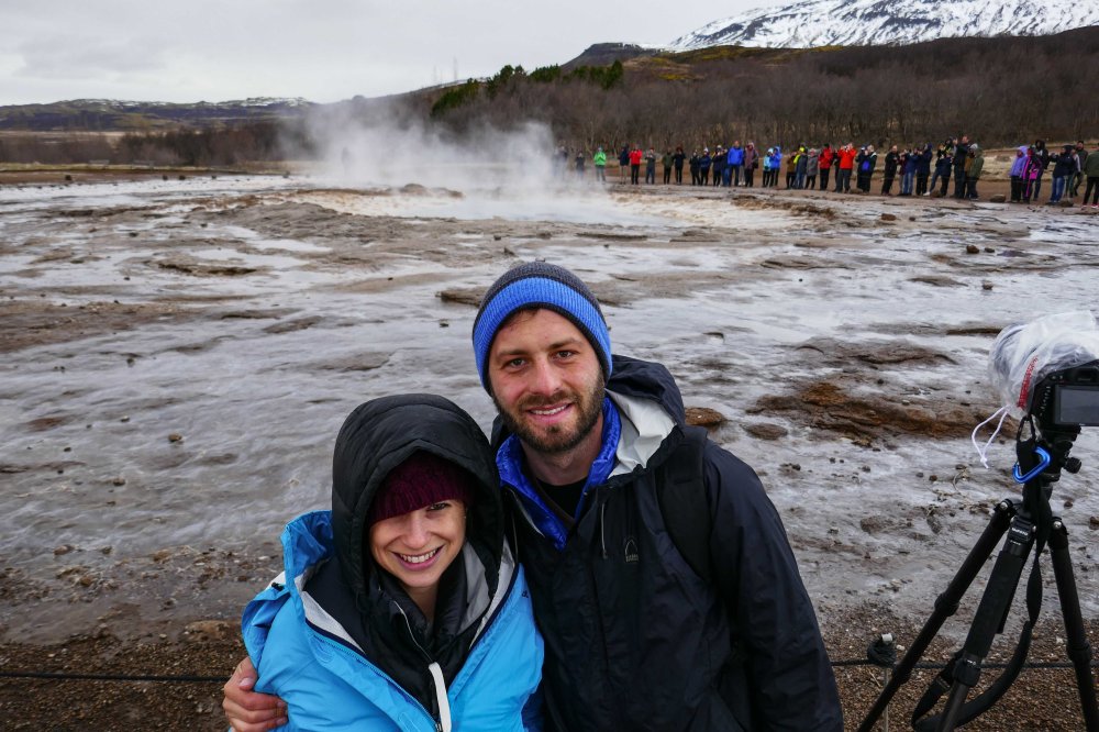
Though Geysir itself is rarely active these days, Haukadalur Valley boasts a plethora of hot springs and geysers, including the powerful Strokkur, Smiður and Litli-Strokkur.
Strokkur is, arguably, the country’s most famous hot spring, shooting vast jets of boiling water from 20 metres (65 feet) up to 40 metres (130 feet) high. Strokkur erupts every five to ten minutes.
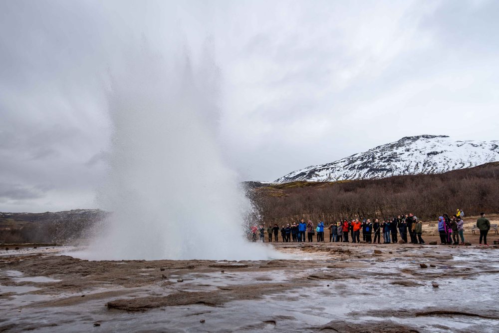
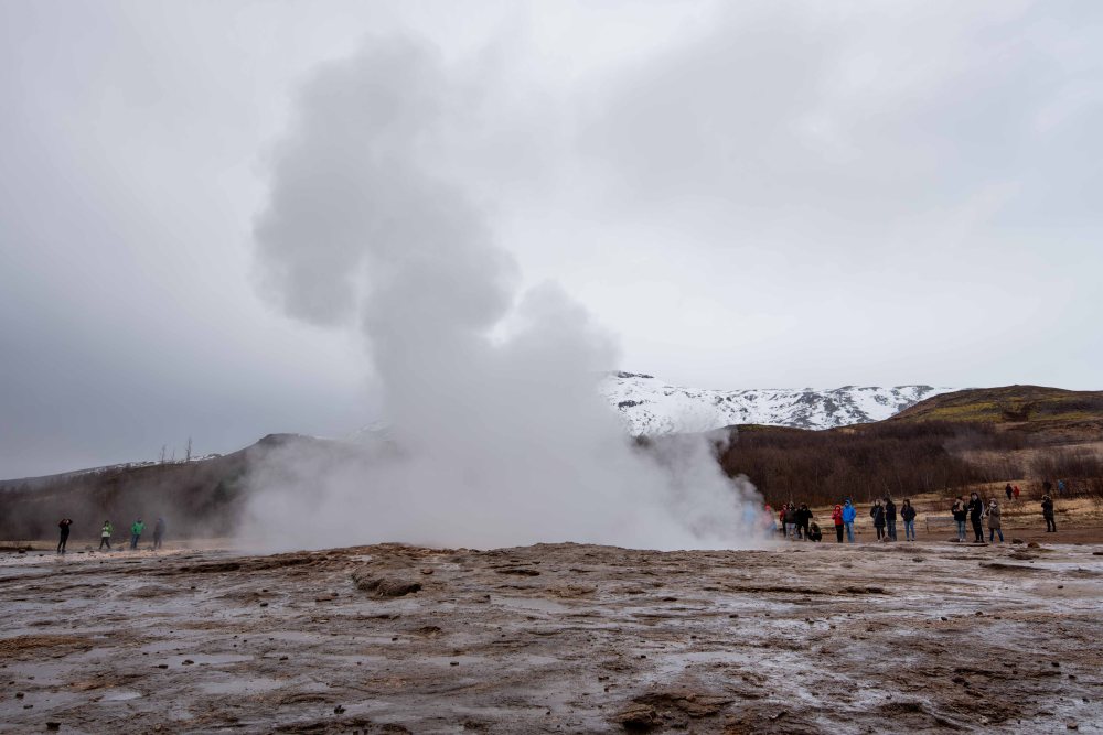
Aside from watching the hypnotic pillars of steam, you will also be able to observe the yellow sulphuric stains along the fumaroles themselves, a result of the earth’s minerals crystallising around the rock bed.


While this geyser field was well worth visiting, since the word “geyser” comes from Iceland, we expected more, especially those of us who have been to Yellowstone, where there are many more geysers and hot pools, which are much more dramatic. So, if all you want to see is geysers, skip Iceland and go to Yellowstone National Park!
We continued our drive southeast until reaching the famous Skogafoss waterfall. Eitan brought his drone to Iceland, but unfortunately, most places don’t allow them anymore, so the drone was barely used.

Skógafoss is one of Iceland’s biggest and most beautiful waterfalls with an astounding width of 25 meters (82 feet) and a drop of 60 meters (197 feet).
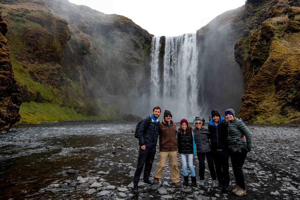
The land underneath the waterfall is very flat, allowing visitors to walk right up to the wall of water. This will get you drenched, although, on a warm summer day, it can be quite tempting. However, we’re unconvinced that they actually have warm days in Iceland.


Skógafoss can also be viewed from the top as a steep staircase leads to an observation platform above the cascade. Many nesting seabirds can be found on the route up. Eitan, Dan and Sarah went up to the top while the rest waited for us down below.

This is the other waterfall that can be seen from the top.

We ended our day in the town of Vik for the night.

We ate some good food in a local restaurant and we had some time to walk around the very small but cute town.

Vík is a remote seafront village in south Iceland. It sits in the shadow of Mýrdalsjökull glacier, which covers the Katla volcano.

Reyniskirkja is a wooden church dating to 1929. Sarah, Aaron and Eitan walked up the hill to the church on top.


We all went to sleep to get some rest as the next day we will be traveling all the way to the town of Hofn.
Bonus pic of the day:
The colors on the Icelandic flag have no official symbolism but one popular modern interpretation is that they represent the three elements that created the island: fire, ice and water. The combination of the traditional Icelandic colors blue and white with red reflects historical links with Norway. The use of the cross symbolizes Iceland’s close ties with the rest of the Nordic countries.

Disclaimer: Most of the information of this post was taken from guidetoiceland.is.

Gorgeous land!!! Beautiful Iceland!!
LikeLike